About Us
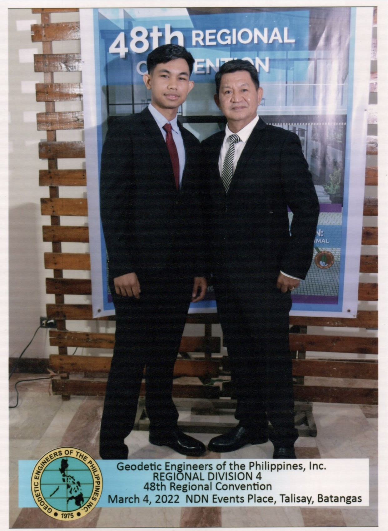
Amason Land Surveying Services, is your trusted partner for all your geomatics needs! Our office was founded by a dynamic father and son duo, both Licensed Geodetic Engineers, who share a passion for precision and excellence.
The name "Amason" carries a deep significance. It symbolizes the strong bond between the father and son, representing their commitment to delivering exceptional surveying services. Moreover, it draws inspiration from Jeff Bezos, the visionary founder of Amazon, underscoring our dedication to innovation and customer-centricity. Most notably, AMA represents God the Father and SON represents Jesus Christ his only begotten son.
Formerly known as E.A. Ilao Surveying Services, we proudly took on the name Amason Land Surveying Services after the founder's son successfully passed the board examination. This momentous achievement marked a new chapter for our company, further solidifying our commitment to excellence.
Situated in the heart of Alfonso, Cavite, our prime location enables us to serve the region efficiently and effectively. With over two decades of experience in the industry, the founder brings a wealth of knowledge and expertise to every project we undertake.
See More
WE ARE EQUIPPED WITH:
Mission
Integrity and Excellence: We prioritize serving our clients with unwavering integrity and a commitment to excellence. We maintain the highest ethical standards, ensuring transparency, honesty, and professionalism in every project. Building lasting relationships based on trust and reliability is our goal.
See More
Vision
Pioneering Sustainable Development: We lead the way in promoting sustainable development through our land surveys and services. Sustainability is at the heart of our mission. By integrating environmentally responsible approaches and cutting-edge technology, we positively contribute to the preservation of our planet and its resources.
See More
Core Values
Reliability: We are committed to being a trusted partner for our clients, delivering survey data and services that they can consistently rely on for making informed decisions.
Teamwork: Collaboration and teamwork are at the heart of our success. We value the contributions of each team member and understand that together, we can achieve remarkable results.
See MoreServices
We use the latest technology and solutions in EDM, laser, GPS/GNSS and drones to complete our services. Our services are aligned with the regulations of land surveying methods as mandated by the DENR.
Land Surveys
Original Survey The unnamed cadastral lots require an actual ground survey and approval from the Department of Environment and Natural Resources-Land Management Service (DENR- LMS)..
Relocation Moving the parcel corners to new locations based on the bearings, distances, and area specified in the approved survey or written in the lease contract, if applicable, or Torrens Title.
Verification Survey Conducting surveys on land parcels suspected of having encroachments.
Resurvey Surveys are conducted with the aim of recording the technical description on the title of a land parcel for which the original technical description is no longer accessible in different government offices.
Subdivision/Consolidation Survey The client may require the division or combination of an untitled or titled property into multiple lots, which is known as segregation or consolidation

Engineering Surveys
As-Built Survey Conducting surveys of current structures, utilities, and improvements for planning and design purposes.
Topographic Survey Performed to assess the topography and layout of the land to aid in planning and design endeavors.
Parcellary Survey Conducting surveys of land parcels situated along a designated alignment to facilitate the design process.
Profile and Cross-Section Creating profiles and cross-sections of highways and existing water bodies.Hydrographic Survey Surveying bodies of water to assess both the depth and the shape of the seabed.
Amason Land Surveying Services
Your Trusted Path to Excellence and Reliable Insights.
Harmonizing dreams, roads, energy horizons, and green havens, our geospatial finesse unveils potential. As you navigate the realm of choices informed, craft blueprints with strategic flair, and weave visionary designs, you emerge as a trailblazer of purposeful transformation
Contact Us
Other Surveying Services
Mineral Land Survey
Performing surveys on meridional blocks to
achieve various mining goals.
Foreshore Land Survey
Conducted to determine the exact boundaries
and measurements of the area included in the
foreshore lease application.
Unmanned Aerial Vehicle (UAV) Mapping
Services
Using unmanned aerial vehicles or drones for
land surveying with a focus on planning and
design objectives.
Ground Control Point (GCP) Establishment
Establishment of ground control points to
serve various surveying needs.
Memorial Park Survey
Planning and arranging the design of memorial
lots.

Other Services
Lot Plan with Vicinity
Preparation of plans to meet local government
requirements, such as Fencing Permit and
Building Permit.
Civil Aviation Authority of the Philippines(CAAP) Height Clearance
Certification of CAAP Height Clearance for
proposed buildings located near existing
airports.
Court Appearance
Serves as a knowledgeable witness during
court proceedings.
Subdivision Scheme
Creation of subdivision designs, ranging from
straightforward to intricate layouts.
Research Work and Due Diligence
Conducting research on relevant documents
from various government agencies and
performing due diligence procedures.
Titling Procedures
Procedures for Administrative or Judicial
titling.
Contact
Contact us, your reliable surveyor, for expert services tailored to your specific needs. We're here to assist you with precision and professionalism.
Our Address
C-5 road, Luksuhin Ibaba, Alfonso,Cavite
Email Us
amasonlandsurveying@gmail.com
Call Us
+639057932833/ +639497640782